Living Firewise in fire country
The 2002 Missionary Ridge Fire burned about 73,000 acres right around the lake; here's how to harden a home and stay ready.
Defensible space: the zones that matter
Colorado State Forest Service breaks defensible space into Home Ignition Zones, and the highest-leverage one is the closest:
- Zone 1 (0–5 ft) — nothing combustible. Gravel, not bark mulch; no woodpile against the house or on the porch; trim anything that touches the siding. This five feet does the most work.
- Zone 2 (5–30 ft) — lean, clean, green. Space and limb trees, mow, break up the ladder fuels that carry fire from grass to crown.
- Zone 3 (30–100 ft) — thin. Reduce density so a crown fire drops to the ground.
Source: CSFS Home Ignition Zone guide.
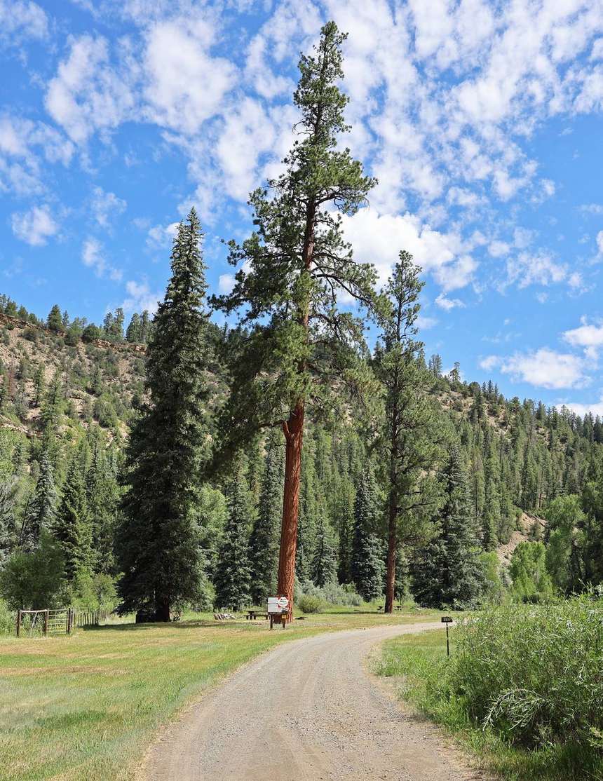
Mitigation is spring chores, not a one-time project — you do a little every year. And the neighbor with the chipper is worth more than the insurance agent. Be both.
Wildfire Adapted Partnership & slash days
Wildfire Adapted Partnership (a Durango nonprofit) will do a free Wildfire Risk Site Visit, which unlocks their Defensible Space Cost-Share reimbursement and a chipper rebate; they also run a Neighborhood Ambassador program. WAP has organized slash-disposal days at the lake — check wildfireadapted.org/calendar for current dates. Source: wildfireadapted.org.
The Vallecito Creek flood-recovery effort runs slash & pine-needle drop days at McCarty's gravel pit, 14015 CR 502 (Fri/Sat, 9–1; no plastic bags, $20/load donation). The 2026 dates (May 15–16 and June 19–20) are completed — next dates are announced in spring. Source: vallecitorecovery.com.
Slash-day dates change each year; confirm with the organizer before you load up.
Vallecito has its own wildfire plan
Vallecito has a Community Wildfire Protection Plan (Nov 2014), hosted by Upper Pine River Fire — the most relevant local document for how fire is expected to move through this valley and where the priorities are. Read it: Vallecito CWPP (PDF). The county also keeps a Wildfire Resource Center.
How wildfire behaves at Vallecito (and why mitigation works)
The clearest case for thinning and defensible space is simply how fire is expected to move through this particular valley. The Vallecito Community Wildfire Protection Plan spells it out — the points below are its findings.
Crown cover is the switch
How close the treetops grow is what flips a fire from survivable to unstoppable. The CWPP gives three bands of expected behavior:
- Under ~35% crown cover — low-intensity surface fire: flames around 5 ft, spread of roughly 1–40 acres/hour, spotting rare. The kind crews can control.
- 35–55% — moderate intensity: flare-ups above the treetops with short- and medium-range spotting that throws new fires ahead of the main one.
- Over 55% — high-intensity crown fire: flare-ups higher than the trees, spread up to several hundred acres/hour, a “fire front impassable,” and spotting of hundreds of yards — possible to a mile or more.
That is the entire logic of mitigation. The CWPP notes that widening the spacing between tree crowns and removing the ladder fuels beneath them “can help lower the likelihood of a crown fire” — in other words, it drops a stand out of that top band and back to a fire people can actually fight. That's what the defensible-space zones above are doing. Source: Vallecito CWPP (2014), fire-behavior section.
Terrain and wind are stacked against the valley
Vallecito slopes south to north between high ridgelines (about 7,600 ft up to over 8,500 ft), and the prevailing wind is from the southwest. Fire preheats the fuel on the slope above it, and upslope/up-valley winds fan it further uphill — so the southwest-facing aspects are the driest and most dangerous, and a fire gets pushed up toward the ridgetop homes. A big fire can also make its own weather, throwing winds from shifting directions — the CWPP calls this “a significant factor in the 2002 Missionary Ridge Fire.” The largest La Plata County fires of the past two decades have run from early June into early August; the July–August monsoon is the relief valve, and in years it arrives late or fails, danger climbs. Source: Vallecito CWPP (2014).
The fuel load is rising, not falling — the burn-scar paradox
It's tempting to assume the 2002 burn left the area safer. The CWPP's findings cut the other way:
- Gambel oak is an aggressive ladder fuel. It “can burn very aggressively” and, beneath conifers, “will readily carry fire from the ground up into the tops of the trees” — and where it burned hot in 2002 it has resprouted from the roots and now dominates parts of the old scar.
- Burned ground is not safe ground. Fires inside the old Missionary Ridge scar — the Red Creek Fire (2010) and the Vallecito Fire (2012) — showed “higher than anticipated fire behavior” because fire-killed timber keeps falling into a “jackpot” of surface fuel.
- A spruce-beetle epidemic is working west into the high country above the Pine River, adding standing-dead fuel.
Source: Vallecito CWPP (2014). The carved trees on the Missionary Ridge Fire story page came from that burn.
Embers — not the flame front — ignite most homes
Most homes lost to wildfire are lit by wind-blown embers, not by a wall of flame arriving at the door — the insight behind the Home Ignition Zone (research by Jack Cohen at the U.S. Forest Service's Missoula Fire Sciences Laboratory). The good news: it means the defensible-space zones above work, and a few home-hardening details matter as much as clearing brush. The CWPP's local guidance:
- An ember-resistant roof (metal, cement-fiber, or tile) and 1/8″ metal screen on soffits and vents so sparks can't lodge in the eaves; enclose open decks.
- Woodpiles and propane tanks at least 30 ft from the house, preferably uphill, with flammable vegetation cleared 10 ft around them.
- Clear pine needles off the roof, gutters, decks and porches every year — a common local vulnerability.
Sources: Vallecito CWPP (2014) for the home-hardening measures; Home Ignition Zone research, USFS Missoula Fire Sciences Laboratory.
One paved route out — so plan to leave early
Vallecito has effectively one paved route in and out (CR 501), and the CWPP records that during the 2002 evacuation CR 501 was closed for a time due to congestion. The takeaway is to leave early and be ready: keep a go-bag packed in fire season, sign up for LPC Alerts, and know your route (including the Florida Road backcountry alternate). See insurance & getting out below for the full evacuation framing. Source: Vallecito CWPP (2014).
Insurance and evacuation
Insurance: wildland-urban-interface underwriting is slow and picky, so bind early. The Colorado FAIR Plan (opened April 2025) is a true last resort — it requires three denials, caps at $750k, and pays actual cash value: a backstop, not a plan. On the upside, HB25-1182 now requires insurers to credit documented mitigation, so keep your receipts and before/after photos. Sources: Colorado Division of Insurance; leg.colorado.gov.
The Colorado FAIR Plan, explained
If carriers won't write or renew a policy here — increasingly common across the Four Corners' wildland-urban interface as insurers pull back from high-wildfire-risk areas — the Colorado FAIR Plan is the state's insurer of last resort. Stood up in April 2025 under the Division of Insurance, it exists so a property isn't left with nothing, but it's deliberately a floor, not a like-for-like replacement for a standard policy:
- Last resort by design — you generally must show you've been denied or non-renewed on the standard market before you qualify.
- Capped coverage — the limit tops out around $750,000, which may not fully rebuild a higher-value home.
- Actual cash value — it typically pays depreciated value, not full replacement cost. Read the terms closely.
- Mitigation counts — under HB25-1182, insurers must credit documented wildfire mitigation, so keep receipts and before/after photos of your defensible-space work.
What to ask before you buy or renew: Is the home insurable on the standard market, and at what price? If not, does the FAIR Plan apply, and what does it actually cover? Will a free Wildfire Adapted Partnership risk visit and documented mitigation lower the premium or unlock a credit?
General information, not insurance advice. Talk to a licensed agent or the Colorado Division of Insurance about your situation. Sources: Colorado Division of Insurance (doi.colorado.gov); leg.colorado.gov (HB25-1182).
Building or remodeling? Colorado's Wildfire Resiliency Code
If you're building new or planning a major exterior remodel, there's a newer rule worth knowing — and it does not touch existing homes. Colorado adopted a statewide Wildfire Resiliency Code (CWRC); jurisdictions with wildland-urban-interface areas had to adopt at least the minimum state code by April 1, 2026, with enforcement beginning July 1, 2026. La Plata County adopted it in March 2026 as Chapter 19, effective June 17, 2026 for permit applications filed after that date. Sources: Colorado DFPC — Wildfire Resiliency Code; Durango Herald.
- Where it applies. Parcels in mapped wildfire-hazard areas on the state's wildfire-resiliency map, rated by projected fire intensity. Much of La Plata County is medium- or high-risk, so both Class 1 and Class 2 standards apply.
- What triggers it — and what doesn't. A building permit for new construction or certain exterior modifications triggers the code. It is not retroactive — a current owner doesn't have to bring an existing home up to it, and smaller non-habitable accessory structures can be exempt.
- What it hardens. The structure-hardening standards cover ember- and flame-resistant roofing, exterior walls, and decking — the same logic as the ember-resistant construction above, now written into the building code for new work.
- How La Plata enforces it — a “carrot.” Rather than added inspections or withholding a certificate of occupancy, the county has owners submit a defensible-space landscape plan and sign an affidavit committing to follow it, and says it won't run routine follow-up inspections. Sources: Durango Herald; LPC Building Division.
Documented mitigation can help on the insurance side too — see the FAIR Plan note on HB25-1182 credits. Colorado's Wildfire Resilient Homes Grant (DFPC) is periodically offered to help homeowners offset hardening costs; check the DFPC grants page for an open application window before counting on it. Source: Colorado DFPC grants.
Getting out: there's effectively one paved route in and out (CR 501), so an evacuation plan matters. Sign up for LPC Alerts!, learn the Ready-Set-Go framework, and read Upper Pine River Fire's Vallecito wildland evacuation plan. Always check the live fire-restriction status before any flame — and see Respect Vallecito on why fireworks are never okay here.
Keep a go-bag by the door in fire season and know two ways down the hill — the paved one and the Florida Road backcountry alternate. The time to learn the second route is not the night you need it.
← All Living in Vallecito guides · Live fire status · Wildfire watch (live map)