First time at Vallecito?
A high-country lake at 7,665 feet with one paved road in and weather that turns fast — here's what first-timers wish they'd known.
Where to stay
Lodging ranges from cabins and lodge rooms to RV parks and campgrounds. A few to start with:
- Cabins & lodges — Pine River Lodge, Elk Point Lodge, and more.
- RV parks — Blue Spruce RV Park & Cabins and 5 Branches Camper Park & Cabins.
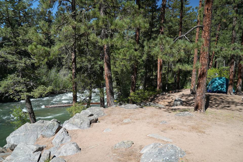
- Camping on a budget — six USFS campgrounds serve the reservoir (vault toilets, mostly no hookups; reserve on recreation.gov). See the full camping guide and the campground layer on the lake map.
See the full list with contacts on the Local Guide Lodging.
How far is the lake?
Vallecito is about 45 minutes from downtown Durango (23 mi of mountain road), but it's a different world up here — higher, colder, and with effectively one paved route in (CR 501; the Florida Road / CR 240 way past Lemon Reservoir is a slower backcountry alternate). From the south and west, you'll come through Durango, then up US-160 and CR 501.
Still deciding which lake to drive to? Vallecito vs Lemon Reservoir compares size, setting, fishing, boating and camping on both.
The last turn trips people up: coming east on US-160 through Bayfield, turn north — a LEFT — onto CR 501, then follow it up the valley to the lake. From Farmington or Aztec, take US-550 north into Durango first (~50 min), then the same US-160 east to that CR 501 turn. From Pagosa Springs, come west on US-160 to Bayfield and the same turn.
Check road conditions before winter trips — CR 501 ices up before the highway does. Statewide info: 511. Once you're up here, the lake map shows campgrounds, boat access, and landmarks.
Check the road first
Eight CDOT cameras cover the approaches — the Bayfield / CR 501 turnoff, US 160 east of Bayfield, and US 550 through Durango. They live with the road status on the conditions page. See the road cameras
What's open, by season
Rough guide only — mountain weather varies a lot day to day. Always check live conditions before you head up.
Summer (Jun–Aug)
Peak season. Marina, restaurants, lodging, and guides are all running. Warm days, cool nights; near-daily afternoon thunderstorms and wind are routine in mid/late summer — get on the water and the trails in the morning. The water stays snowmelt-cold into June.
Fall (Sep–Oct)
The locals' favorite: crisp, often clear, the best all-around fishing of the year, golden aspens, and thinner crowds. Cold nights — frost likely. Some seasonal businesses wind down after Labor Day, so call ahead.
Winter (Nov–Mar)
Quiet and cold and snowy. Cross-country skiing, snowshoeing, ice fishing, and the late-February ice-fishing tournament. CR 501 ices up before the highway — check roads. Many services are seasonal; confirm before you come.
Spring (Apr–May)
Mud, runoff, and rising water; variable — pack for anything. Ice-out brings shallow pike and trout and the fishing turns on. Trails up high are still snowed in — stick to lower routes.
What to pack for the high country
- Layers. At ≈7,665 ft, mornings and nights are cold even in July — it can be 80° at midday and near freezing at night, any month. Pack a fleece or jacket alongside your shorts.
- Sun protection. Thin mountain air means strong UV: sunscreen, hat, sunglasses.
- Water. Altitude dehydrates you faster than you'd think. Drink more than usual.
- A rain shell. July–August afternoon thunderstorms (monsoon season) roll through most days — be ready to get off the water and under cover.
- Cash + a paper/offline map. Cell service is spotty around the lake (more below), so don't count on directions or payments going through.
- A full tank, snacks, and a plan B for when the trailhead lot is full.
Fuel & supplies
Top off in Bayfield or Durango on the way up, but you've got two solid options right at the lake:
- Vallecito Marina — on-the-water fill-ups, the easy choice if your boat's already in.
- Vallecito Lake Country Market — gas and propane at the lake, handy for boats, ATVs, and side-by-sides so you don't have to run to town. Best bet for trailered rigs.
For groceries, ice, and basics, the Country Market has you covered. Cell service is spotty, so download maps and screenshot the emergency contacts before you lose signal.
Permits & passes
Fishing, boating, OHV, and Wilderness permits are all laid out — with prices and direct buy links — in our Licenses & Permits guide. Quick version: a PRID reservoir permit (from $6/day per vehicle) covers the lake, the public ramp is open May 1–Nov 1, and you can buy from PRID ((970) 884-2558), Pine River Lodge, or the marina. Some winter Nordic areas charge a separate PRID land-use fee.
What a Vallecito trip costs
An honest rundown of the real costs. Every figure here is one you'll find elsewhere on this site, linked so you can check it — we don't quote lodging, rental, or meal prices here; book those direct.
| What | Cost | Where it's kept current |
|---|---|---|
| PRID reservoir permit | from $6/day per vehicle | Licenses & Permits |
| Fishing licence (CPW) | $44.87 resident annual · $18.07 for a day | Licenses & Permits |
| Camping | varies by site and season | Camping guide · rec.gov |
| OHV registration | $26.25/yr · hiking and Wilderness are free | Licenses & Permits |
| Getting here | fuel for ~45 min / 23 mi from Durango | Fuel & supplies |
We deliberately don't print lodging, marina-rental, or restaurant prices here — those change and belong to the businesses. Find them in the local guide and book direct. Planning around mobility? See easier access & the accessible pier.
Best first-day activities
- Get on the water — rent a boat, kayak, or SUP at the Vallecito Marina. A PRID reservoir permit is required (from $6/day per vehicle) — see Licenses & permits.
- Cast a line — seven species and four seasons; see the fishing guide and local guides.
- Stretch your legs — an easy lakeside walk or a hike into the Weminuche; see Things To Do Trails.
- Do the Tour of Carvings — fourteen chainsaw sculptures around the lake (free, self-guided).
- Get oriented — find campgrounds, boat access, and landmarks on the lake map.
Easier access
Much of Vallecito's shoreline is rugged national-forest land, but there are a couple of easier-access spots worth knowing:
- A wheelchair-accessible fishing pier at the Vallecito Marina — a stable, level place to fish without scrambling over rocks.
- Old Timers Day Use Area (east shore) — a gravel boat ramp and a handful of shaded picnic tables, an easy place to reach the water for a picnic or a cast.
We list only what's confirmed. If you need specifics — pier length, surface, parking — the marina is the best source: (970) 884-7000.
Swimming & the water
There's no designated swim beach and no lifeguard at Vallecito — it's an open mountain reservoir. People do swim and wade, most often near the day-use areas and quieter coves, but go in with eyes open:
- The water is snowmelt-cold well into summer — cold-water shock is real, so ease in rather than jumping.
- Watch boat traffic. It's a busy motorized lake — stay near shore and out of the boat lanes, and use a dive flag if you swim away from the bank.
- No services. No guarded area or rinse stations; supervise kids closely and keep flotation handy.
Dogs at Vallecito
Yes, this is good dog country — but it's also bear and moose country, so a few rules and habits matter:
- Campgrounds & developed areas — leashed. In developed recreation sites on the San Juan National Forest, a pet must be on a leash no longer than six feet or otherwise physically restrained (the Forest Service rule, 36 CFR 261.16).
- Trails & the Weminuche — under control. Dogs are welcome on the trails and in the Weminuche Wilderness but must be kept under control — up here that really means leashed or right at heel. Trail guide
- This is why: moose and bears. CPW calls moose the most dangerous animal here, and unleashed dogs are the number-one trigger for moose charges. Keep your dog close, leash near willows and water, clean up after it, and feed pets indoors in bear country. Wildlife guide
- Staying with a dog. Pet policies vary by cabin and lodge and we don't publish them second-hand — call the property to confirm before you book. Where to stay
Day-use spots like Old Timers (east shore) are easy places to give a leashed dog a lakeside break.
Common first-timer mistakes
- Not checking fire restrictions. Stage 1/2 bans affect campfires, charcoal, and more. Check the current fire-restriction status before you plan a fire.
- Assuming full cell coverage. Service is spotty around the lake — download maps offline and screenshot key info first. (Details: Internet & Cell.)
- Expecting full services at the lake. The Country Market (groceries + gas & propane) covers the basics, but the nearest full grocery/fuel/medical is in Bayfield (~20 min) or Durango (~45 min). The remoteness is part of the deal — stock up on the way, and know where care is before you need it:
Clinic, ER and emergency numbers are kept together: emergency & lake contacts
- Getting caught by afternoon storms on the water. Watch the sky in July–August and head in early; wind also typically comes up by mid-afternoon.
- Showing up without prepping your boat. Trailered and motorized boats are inspected for aquatic nuisance species (ANS) at the ramp before launch — arrive clean, drained, and dry to speed through. The full clean-drain-dry walkthrough and what to expect at the station is on Launch Your Boat.
- Not knowing the local standards. A few shared habits — slow on the county roads, OHVs on the legal trails, bear-secure trash, no fireworks — are how this valley stays pristine. Two minutes on Respect Vallecito and the wildlife guide makes you a welcome neighbor.
Common questions
Best time to visit, trip cost, boat launching, cell service, dogs, swimming, permits, campgrounds — the short answers live on the Vallecito Lake FAQ, our single source for them so they stay current with the season and the water year.